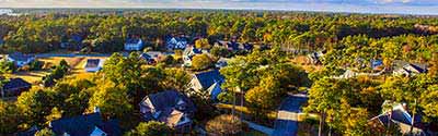
The Iowa Neighborhood Explorer helps you to research any Iowa neighborhood (census block group) and get home values, average household income, owner/renter/ occupancy rates, projected growth rates, boundary maps, comparisons to other communities, and much more.
Iowa State Flower - Wild Rose
The United States acquired the area of Iowa from France in 1803 as part of the Louisiana Purchase. Iowa Territory was organized on June 12, 1838, from part of Wisconsin Territory; it included all of present-day Iowa, the eastern part of North Dakota and South Dakota, and the western part of Minnesota. Iowa was admitted to the Union on December 28, 1846, as the 29th state with generally the same boundary as the present state. The remaining part of the territory was unattached until the organization of Minnesota Territory in 1849. Nebraska and Iowa have made periodic adjustments to their boundary as the Missouri River has changed its course.
Census data for Iowa are available beginning with the 1840 census. The 1840 population includes the portion of Iowa Territory in present-day Minnesota west of the Mississippi River and a line drawn from its source northward to the Canadian boundary.
See: Geographic Terms & Concepts
Interactive Map of Iowa Counties | Static Overview Map of Iowa Counties
There are 99 counties in Iowa. All counties in Iowa are functioning governmental units; each governed by a county board of supervisors.
-- Select County --
Adair County
Adams County
Allamakee County
Appanoose County
Audubon County
Benton County
Black Hawk County
Boone County
Bremer County
Buchanan County
Buena Vista County
Butler County
Calhoun County
Carroll County
Cass County
Cedar County
Cerro Gordo County
Cherokee County
Chickasaw County
Clarke County
Clay County
Clayton County
Clinton County
Crawford County
Dallas County
Davis County
Decatur County
Delaware County
Des Moines County
Dickinson County
Dubuque County
Emmet County
Fayette County
Floyd County
Franklin County
Fremont County
Greene County
Grundy County
Guthrie County
Hamilton County
Hancock County
Hardin County
Harrison County
Henry County
Howard County
Humboldt County
Ida County
Iowa County
Jackson County
Jasper County
Jefferson County
Johnson County
Jones County
Keokuk County
Kossuth County
Lee County
Linn County
Louisa County
Lucas County
Lyon County
Madison County
Mahaska County
Marion County
Marshall County
Mills County
Mitchell County
Monona County
Monroe County
Montgomery County
Muscatine County
O'Brien County
Osceola County
Page County
Palo Alto County
Plymouth County
Pocahontas County
Polk County
Pottawattamie County
Poweshiek County
Ringgold County
Sac County
Scott County
Shelby County
Sioux County
Story County
Tama County
Taylor County
Union County
Van Buren County
Wapello County
Warren County
Washington County
Wayne County
Webster County
Winnebago County
Winneshiek County
Woodbury County
Worth County
Wright County
There are 1,661 county subdivisions in Iowa known as minor civil divisions (MCDs). There are 1,598 townships. There are 59 cities that are independent of any MCD and one city (Tabor) that is partially independent of any MCD creating 62 county subdivisions. There is also one unorganized territory (reservoir property in Polk County).
Iowa township officials have minimal powers and are under the fiscal authority of the county. These townships, by agreement with the state, are classified as nonfunctioning MCDs by the Census Bureau. The governing body for each township is the board of township trustees.
Iowa State Bird - Eastern Goldfinch
Iowa has 1,009 places; 947 incorporated places and 62 census designated places (CDPs). The incorporated places are all cities. There are 887 incorporated places that are dependent within county subdivisions. Fifty-two cities are legally coextensive with county subdivisions, eight cities are independent of any township, and one city (Tabor) is independent of any township in Fremont County and dependent in Mills County.
Alphabetical List of Cities, Towns, CDPs and Other Populated Places A | B | C | D | E | F | G | H | I | J | K | L | M | N | O | P | Q, R | S | T | U, V | W, X, Y, Z
Iowa Civil Features : Political Subdivisions, Native Areas, Land Grants, etc. - sorted by Census Class Codes .
There are 7 Metropolitan and 14 Micropolitan Statistical Areas in Iowa. IA Metopolitan & Micropolitan Areas
Iowa has 99 urban areas; 9 urbanized areas and 90 urban clusters. View Iowa ZIP Codes and ZIP Code Maps .
Iowa has 364 unified school districts. View Iowa Public and Private Schools .
Iowa has 4 congressional districts. An interactive map shows the contact information for each Representative as well as the boundaries for each Iowa district. View Map of Iowa Congressional Districts .
There are 50 state senate districts and 100 state house districts in Iowa.
Iowa has four federally recognized American Indian areas. There are three reservations and one trust land.